


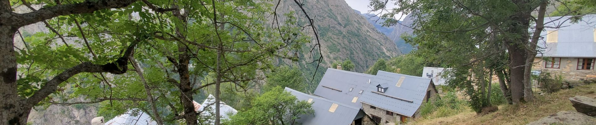
st crhistophe en oisan

TOULAUDIN
User
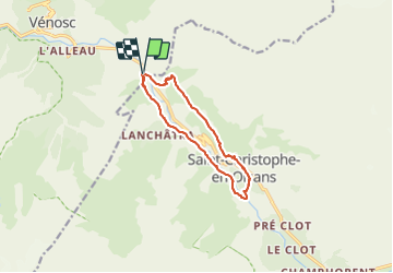

Length
11.5 km

Max alt
1619 m

Uphill gradient
571 m
Km-Effort
19.2 km

Min alt
1169 m

Downhill gradient
574 m
Boucle
Yes
Creation date :
2023-08-10 07:12:33.667
Updated on :
2023-08-10 14:18:09.379
3h55
Difficulty : Medium

FREE GPS app for hiking
 SityTrail
IGN / Geographical institutes
SityTrail Plus
The world is yours!
About
Trail Walking of 11.5 km to be discovered at Auvergne-Rhône-Alpes, Isère, Les Deux Alpes. This trail is proposed by TOULAUDIN.
Photos


Positioning
Country:
France
Region :
Auvergne-Rhône-Alpes
Department/Province :
Isère
Municipality :
Les Deux Alpes
Location:
Vénosc
Start:(Dec)
Start:(UTM)
274886 ; 4984556 (32T) N.
Comments